Indonesia Seismic Crisis: 38 Dead as Twin Earthquakes Trigger Evacuations and Rescue Operations
Authorities confirm rising death toll and trapped survivors as landslides and aftershocks hamper efforts in the Pacific Ring of Fire.
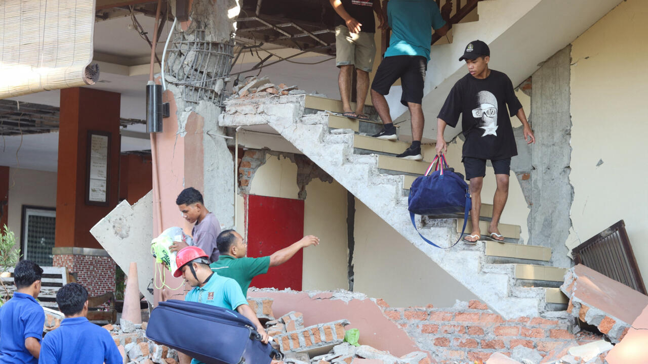
Indonesia is grappling with a dual seismic crisis after a magnitude 7.7 earthquake struck Flores island in eastern Indonesia on 15 August 2026, killing at least 38 people and trapping several others under collapsed buildings. The disaster was compounded late that same day by a magnitude 6.9 earthquake in western Sumatra, according to the US Geological Survey. Rescue operations are currently underway amidst landslides and numerous aftershocks, with the strongest secondary tremor measuring magnitude 6.1.
The initial shock, centred approximately 68 kilometres northwest of the coastal town of Ende, caused significant structural damage in areas comprising mostly towns and villages with few high-rise buildings. An official from Indonesia’s disaster agency confirmed that the 38 fatalities were spread across four different towns on the island, which is popular with tourists. Two individuals were known to be trapped alive under rubble in the neighbouring Manggarai regency, while one deceased person was recovered from debris at the port of Maumere.
Rescue efforts have been severely complicated by landslides that have cut off several roads, isolating affected communities. Fathur Rahman, a rescue official, stated that the primary focus remains locating victims buried under rubble. Video footage released by the agency showed rescuers pulling a body from the debris of a partially collapsed building in Maumere, where two people had previously been evacuated alive.
Tsunami warnings were issued and subsequently lifted, prompting mass evacuations as residents fled to higher ground. In Nagekeo, the area closest to the epicentre, witnesses reported the sea retreating before the quake, a potential precursor to tsunami activity. Dozens of aftershocks have been felt, and authorities have warned against returning to damaged structures. Indonesia’s Meteorology, Climatology, and Geophysics Agency (BMKG) director Wijayanto confirmed that while the tsunami warning had ended, sea levels would remain under close monitoring.
Indonesia’s location within the Pacific “Ring of Fire” exposes the nation to frequent seismic activity. The region has a history of devastating earthquakes, including a 1992 magnitude 7.7 quake on Flores that killed around 2,500 people, the 2004 Sumatra tsunami which claimed over 220,000 lives regionally, and the 2018 Palu earthquake and tsunami that resulted in more than 4,300 deaths or missing persons. The full extent of the damage and the total number of casualties from the 2026 events are still being assessed.