Seismic volatility in 2026 underscores infrastructure fragility over magnitude
A review of six major earthquakes this year reveals that disaster severity is dictated by building standards, depth, and location, rather than Richter scale readings alone.
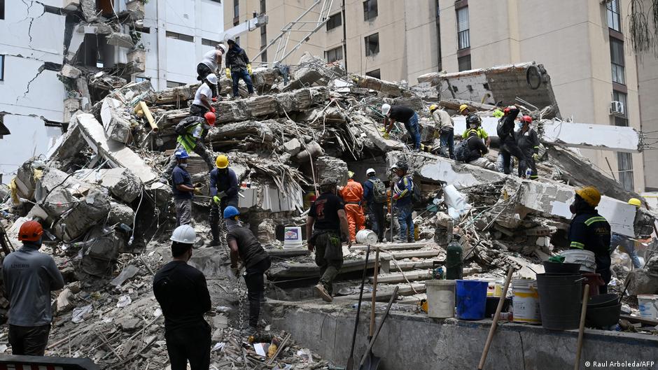
The global seismic landscape in 2026 has been defined by a stark divergence between earthquake magnitude and human cost. According to data from Deutsche Welle World, six major earthquakes have occurred this year, with the deadliest event in Venezuela claiming over 6,300 lives. These events collectively demonstrate that while tectonic activity remains a constant, the scale of disaster is increasingly determined by infrastructure quality, depth, and geographic location.
By mid-August 2026, ten earthquakes registering above magnitude 7 had been recorded globally. This figure aligns with the long-term average of approximately 15 such events per year, suggesting that 2026 is not statistically anomalous in terms of frequency. However, the devastation wrought by these quakes has been striking, particularly in regions with inadequate building construction and underdeveloped disaster response protocols.
The most lethal incident occurred in Venezuela on 24 June, where a magnitude 7.2 quake was followed 39 seconds later by a magnitude 7.5 event. The north of the country and the capital, Caracas, were the hardest hit. Researchers at Oregon State University provisionally assessed that more than 58,000 buildings may have been damaged or destroyed, highlighting the vulnerability of the nation's infrastructure to even moderate seismic forces.
In contrast, the Philippines experienced the strongest quake of the year so far on 8 June. A magnitude 7.8 event off the coast of Mindanao, at a depth of 57 kilometres, killed at least 107 people. The significantly lower death toll compared to Venezuela, despite the higher magnitude, illustrates that seismic strength does not necessarily correlate with the severity of consequences when structural resilience varies.
Latin America faced further disruption on 10 August when a magnitude 7.4 earthquake struck the Choco region near San Jose del Palmar. Although the quake occurred at a depth of 100 kilometres, it killed more than 250 people. Landslides and damaged roads have hampered search and rescue efforts, underscoring the challenges of accessing remote areas and delivering supplies in the aftermath of such events.
Other significant events included a magnitude 7.5 quake in Tonga on 24 March and a magnitude 7.4 undersea earthquake off Japan’s Sanriku Coast on 20 April. The Tonga event, occurring at a depth of 230 kilometres, caused no reported deaths or damage, while the Japan quake, though triggering a tsunami warning, did not result in a major tsunami. These incidents further reinforce the role of depth and location in mitigating disaster scale.
Even lower-magnitude events can have deadly consequences in poorer countries. A magnitude 5.8 quake in Afghanistan’s Badakhsham province on 3 April killed at least 12 people. This aligns with broader observations that inadequate building construction and difficulty accessing remote areas can turn slight tremors into catastrophic events.
The Pacific Ring of Fire, a 40,000-kilometre volcanic belt where several tectonic plates collide, remains the epicentre of much of this activity. Japan’s location on this belt, which gained notoriety after the 2011 magnitude 9 earthquake and tsunami, continues to expose the region to significant seismic risk, as evidenced by the recent activity off the Sanriku Coast.