Curiosity Rover Climbs 24-Degree Slope to Investigate Martian Geological Discontinuity
The rover’s ascent to the suspected erosional supersurface allows for high-resolution analysis of sedimentary structures and atmospheric conditions.
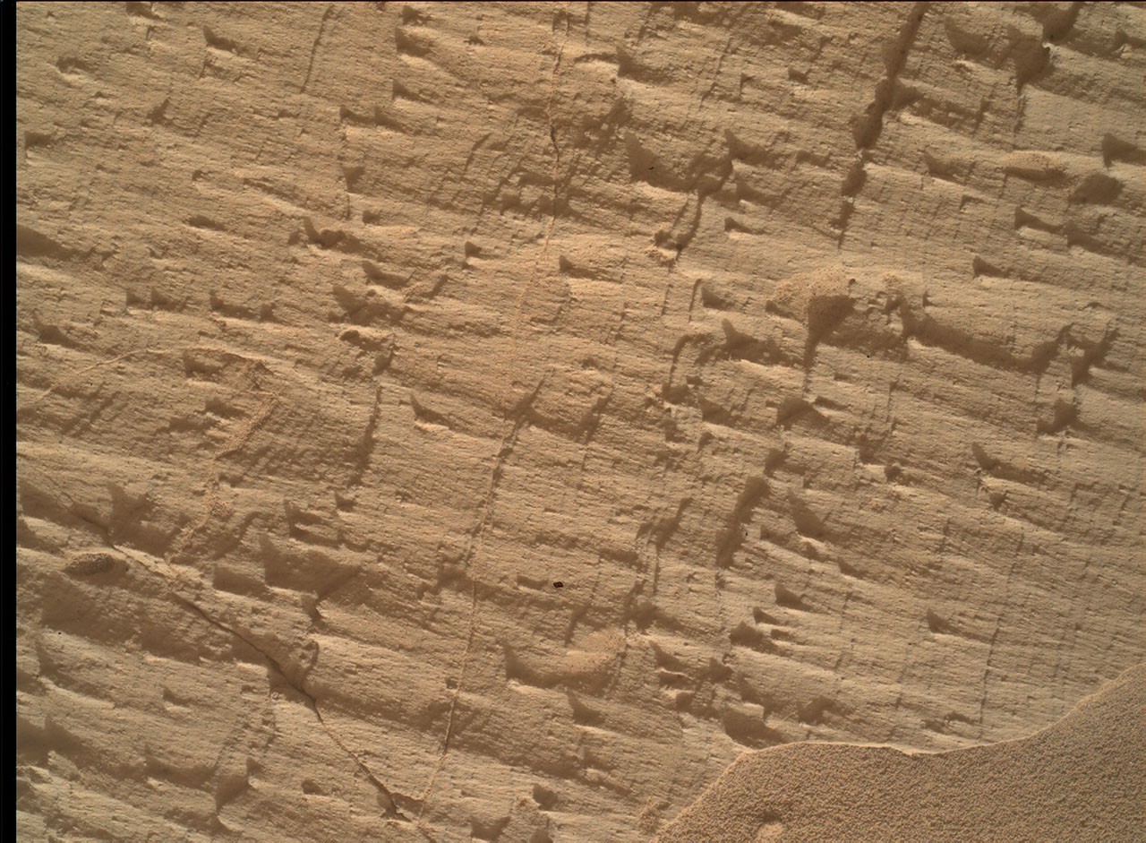
NASA’s Curiosity rover has climbed a 24-degree slope within Gale Crater to investigate a suspected erosional supersurface, a geological discontinuity that marks a transition from a net depositional environment to a net erosional one. This shift in the rock record indicates a period where erosion, potentially driven by wind, water, or both, occurred before the environment returned to deposition.
During Sols 4968 to 4974, corresponding to the Earth planning date of Friday, July 31, 2026, the mission team utilised the Mastcam, MAHLI, APXS, and ChemCam instruments to characterise the rock layers beneath and atop the feature. The rover reached detailed imaging range of the Cerro Paine Grande vertical exposure just below the candidate supersurface before ascending to the top.
The ascent required precise navigation, leaving the rover at an approximate 24-degree tilt in its final parking spot. This posture approached the mission’s contact science tilt record of 27 degrees, enabling the team to facilitate detailed analysis of sedimentary structures and atmospheric conditions that would be difficult to capture from a level position.
Mastcam played a central role in the operation, capturing large stereo mosaics of the vertical outcrop face and a 360-degree panorama after the rover climbed. Meanwhile, the MAHLI camera and geochemical instruments provided detailed characterisation of the bedrock. On Sol 4968, Lucy Lim, the Geology and Mineralogy Theme Lead at NASA’s Goddard Space Flight Center, co-targeted the Puyehue site with APXS, MAHLI, and ChemCam LIBS.
Other targets on Sol 4968 included Lago Palena and Piedras Juntas for LIBS observations, and Cormudesi for an APXS measurement to assess sand composition consistency. In the Sol 4972 workspace atop the slope, bedrock was divided between a smooth, light-toned surface measured at Sierra de Sangre and a darker, rougher exposure targeted at Laguna del Laja.
The week’s observations also included a MAHLI mosaic of fine-scale sedimentary structures at Longquimay, supported by Mastcam M100 imaging. The science team completed the cycle with long-distance ChemCam RMI mosaics of distant sedimentary structures and regular measurements of the modern Martian environment, including atmospheric opacity and a passive-sky survey to monitor minor atmospheric gases.