Trump map depicting US expansion triggers diplomatic backlash
An uncaptained AI-generated image showing Canada, Mexico, Greenland, Iceland and Caribbean territories within an expanded United States has drawn formal objections.
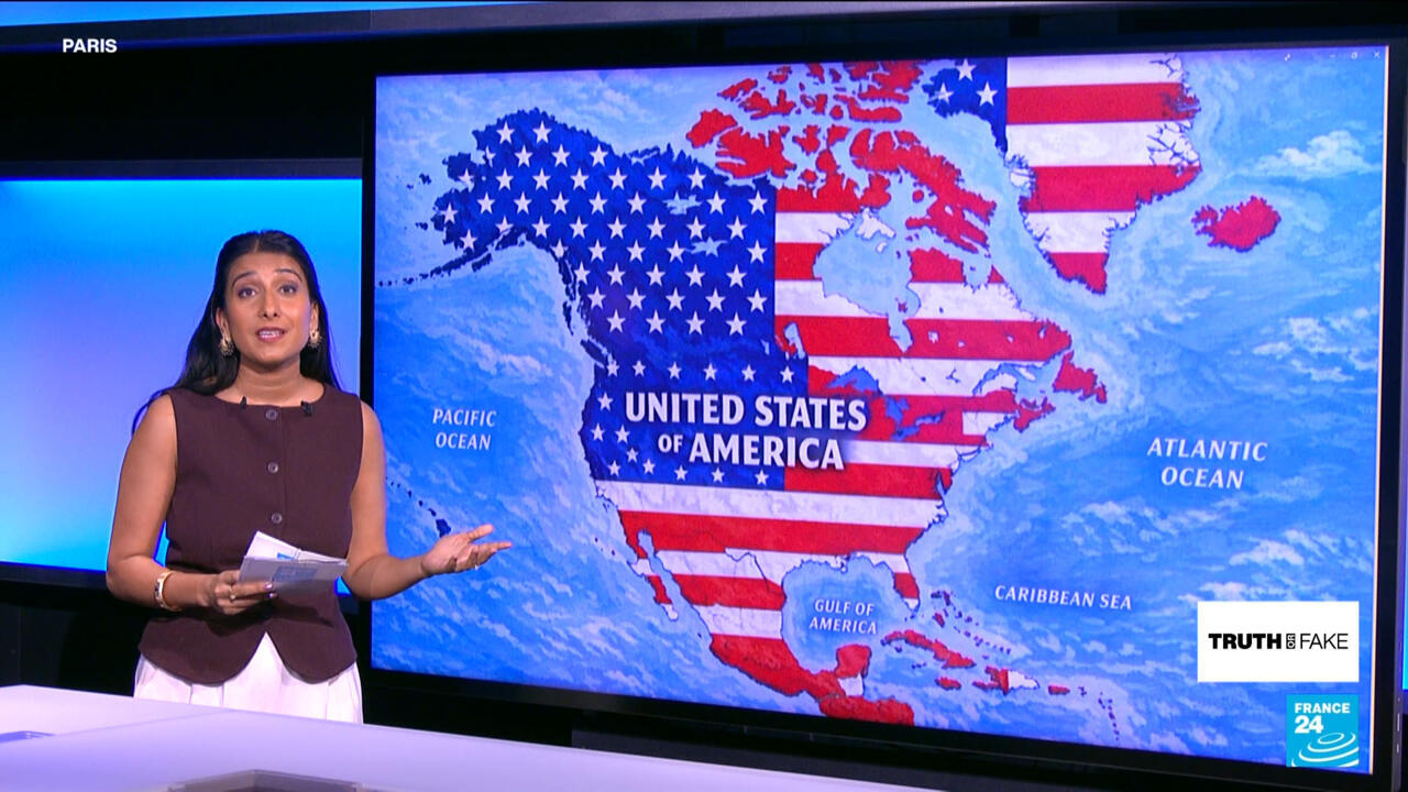
US President Donald Trump has shared an AI-generated map on Truth Social depicting Canada, Mexico, Greenland, Iceland, Cuba and parts of the Caribbean as incorporated into an expanded United States.
The image, posted without a caption or explanation, labels the enlarged territory the “United States of America”. It also calls the Gulf of Mexico the “Gulf of America”, reflecting Trump’s recent executive order to rename it.
The post prompted diplomatic responses from several governments. Iceland reportedly summoned the US ambassador and described the image as “entirely inappropriate”, while Mexican President Claudia Sheinbaum reaffirmed that Mexico was a free, independent and sovereign nation.
Denmark reiterated its opposition to any US takeover of Greenland. Prime Minister Mette Frederiksen said Greenland’s government and people had repeatedly made clear they did not want to become American.
The map follows Trump’s earlier suggestions that Canada could become the 51st US state, his interest in acquiring Greenland and remarks about the United States “taking back” the Panama Canal. France 24 reported that the intention behind the latest image remained unclear, with no indication that it represented an official policy announcement.