Satellite captures autumn colours along Nunavut river
Landsat 9 imagery shows red, orange and yellow vegetation near Kugluktuk, where seasonal colour change typically peaks around mid-September.
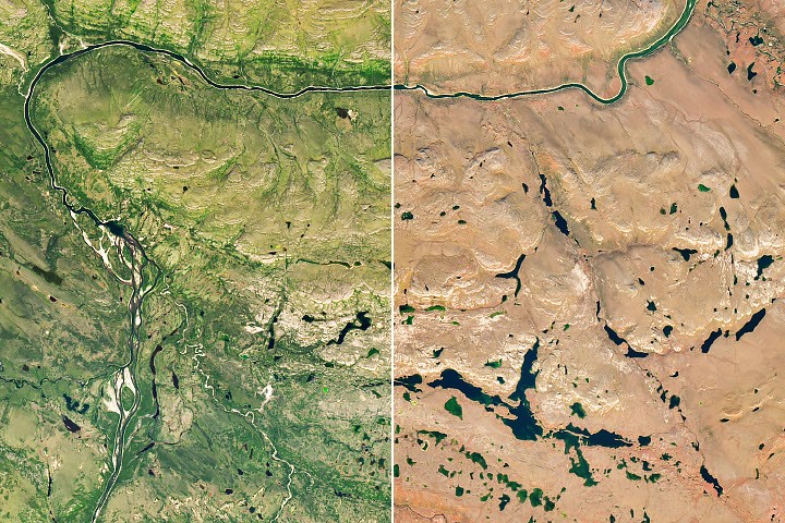
Autumn colours have appeared along the Coppermine River near Kugluktuk in Nunavut, Canada, with Landsat 9 imagery showing red, orange and yellow vegetation on 6 September 2026.
The image, captured by the satellite’s Operational Land Imager, contrasts with imagery from the same area on 27 July, when the vegetation was still green. The river winds through low-growing shrubs and tundra vegetation upriver from Kugluktuk, a community at the river’s mouth.
An analysis by NASA and South Dakota State University of seven years of satellite data found that seasonal colour change in the region begins in early September and generally peaks around the middle of the month. In far northern regions, peak colour can last a week or less.
The tundra vegetation includes willow and birch shrubs, blueberries and bearberries. As days shorten and temperatures fall, plants produce less chlorophyll, allowing yellow carotenoids and red anthocyanins to become more visible.
NASA said citizen scientists can help track seasonal leaf changes through the GLOBE North American Phenology Campaign, contributing observations to long-term environmental databases.