NASA validates DAVINCI Venus probe cameras at Utah test site
Field tests at Crater Island, a geological analogue to Venus, confirmed the mission’s ability to map the Alpha Regio region during its planned atmospheric descent.
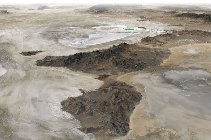
NASA scientists and engineers have successfully field-tested the camera systems and instruments for the DAVINCI mission at Crater Island in Utah. The site was selected for its geological resemblance to the Alpha Regio region on Venus, earning it the nickname “Venus on Earth” due to its composition of sedimentary rocks and igneous intrusions.
The tests, conducted in June 2026, involved suspending the equipment from a helicopter to capture images of rock formations as it descended toward the surface. The camera system recorded hundreds of images of various rock units, including iron-rich and silica-rich formations, to simulate the conditions the probe will face in the thick atmosphere of Venus.
Using only the images acquired by the DAVINCI camera systems, the team generated three-dimensional maps of the area. These maps were consistent with existing geological data, validating the system’s capability to map the geology of the target region on Venus. This success provides confidence that the instruments can operate effectively during the mission’s critical phase.
The DAVINCI probe is designed to descend through Venus’s atmosphere for 60 minutes. During this period, it will capture near-infrared images, measure atmospheric chemistry, and explore the environment of the planet in unprecedented detail. The validation at Crater Island is a key step in ensuring the probe can photograph mountains at scales finer than those available from satellite imagery.
Crater Island is part of the landscape left behind by ancient Lake Bonneville, which formed approximately 55,000 years ago. As the lake receded, it exposed flat playas and salt flats, as well as rugged terrain composed of erosion-resistant bedrock. The island itself is built from silica-rich sandstones and quartzites, along with intrusions of quartz monzonite and granites.
The geological complexity of the site, shaped by crustal stretching and the formation of fault-block mountains, makes it an ideal environment for testing instruments intended to navigate the varied terrain of Venus. The alignment of the new three-dimensional maps with established geological records confirms the reliability of the DAVINCI imaging package for future planetary exploration.