Drone imagery reveals scale of Spanish wildfire devastation
New visual evidence released by Al Jazeera Global News underscores the environmental impact of a recent disaster in Spain, where over 30,000 hectares of land were affected.
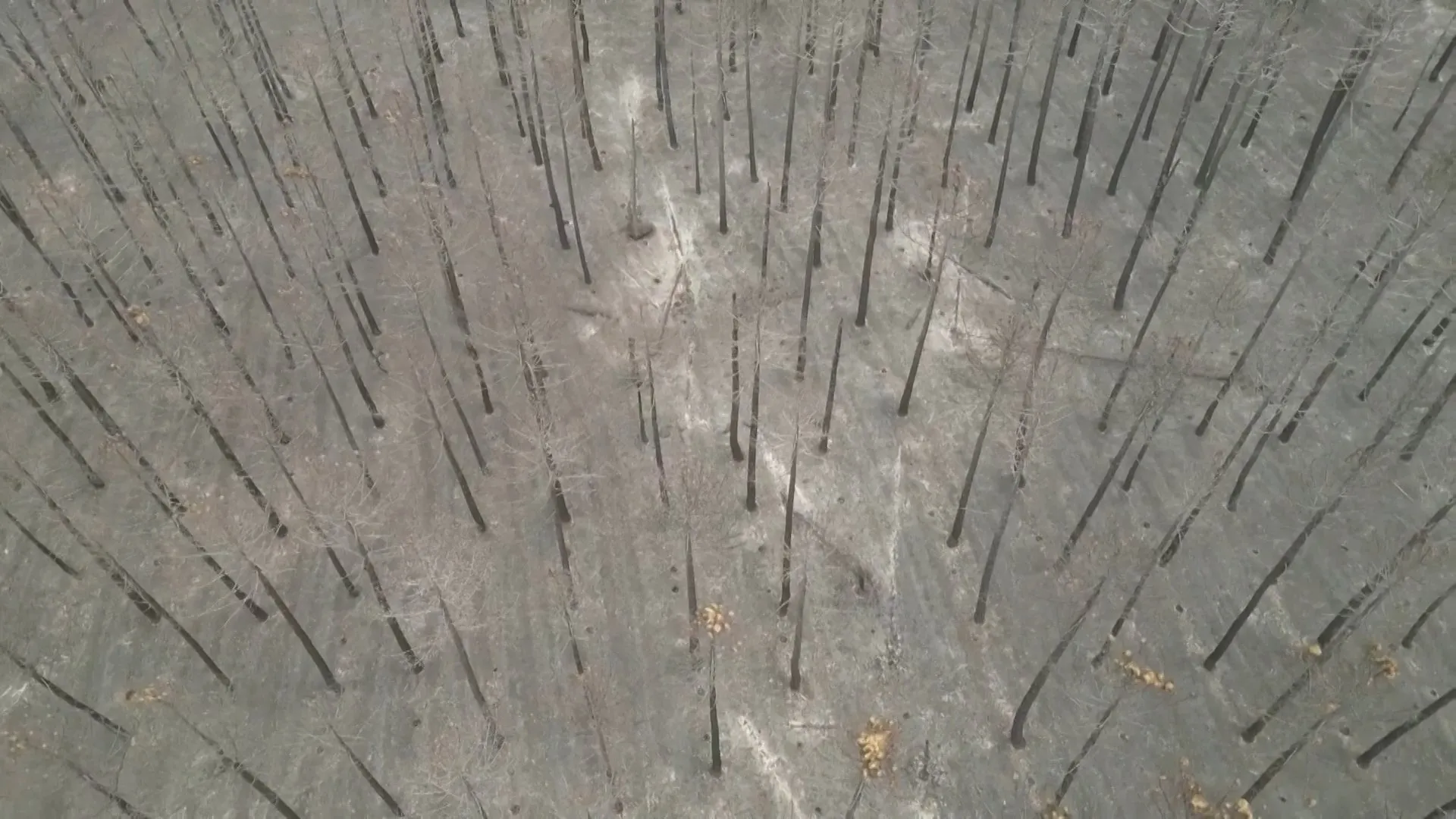
Drone footage has provided a stark visual record of the aftermath of a significant wildfire in Spain, revealing a landscape heavily scorched by the blaze. The aerial imagery, reported by Al Jazeera Global News, documents the extent of the damage to a forest area that was impacted by the fire.
According to the report, the wildfire burned through more than 30,000 hectares of land. The drone captures show the remains of the forest following the event, offering a clear view of the ecological disruption caused by the disaster. The footage serves as primary visual evidence of the scale of the incident.
The specific location of the wildfire within Spain has not been identified in the available reports. While the event is categorised under disaster and security topics, details regarding the province or municipality where the fire occurred remain absent from the source material.
The report does not specify the cause of the wildfire, nor does it provide casualty figures or estimates of property damage. The focus of the released information is strictly on the visual documentation of the burnt landscape and the reported area of land affected.
The footage was published on 21 July 2026. The source material notes a duplication in the initial feed text, but the core facts regarding the drone imagery and the 30,000-hectare figure remain consistent. Independent verification of the exact area burned is not available at this stage.
As the event falls under security and disaster classifications, the release of this imagery highlights the ongoing challenges related to environmental hazards and land management in the region. Authorities have not yet released further details regarding the containment or investigation of the fire.