Wildfire smoke erases decade of US air quality gains, NASA study finds
A NASA-funded analysis using artificial intelligence and satellite data shows wildfire emissions have significantly worsened ground-level ozone across the contiguous United States, contributing to hundreds of additional premature deaths annually.
Wildfire smoke has significantly worsened ground-level ozone pollution across much of the contiguous United States over the last decade, offsetting nearly four years of national air quality control gains, according to a NASA-funded study published in the journal Science on June 4.
The research indicates that while ozone levels generally declined between 2003 and 2015 due to reduced emissions of ozone-forming pollutants, those gains slowed or reversed after 2015. Wildfire emissions were identified as the primary factor in this shift, with the Midwest and West experiencing the most pronounced setbacks. In the Midwest alone, wildfires erased approximately 5.3 years of progress since 2015.
To construct a high-resolution dataset spanning 2003 to 2024, researchers utilised deep learning to combine data from roughly 1,000 ground-based air quality stations with atmospheric models, weather information, and satellite observations from NASA’s Visible Infrared Imaging Radiometer Suite (VIIRS) and Moderate Resolution Imaging Spectroradiometer (MODIS) instruments. This approach allowed for daily surface ozone estimates on a kilometre-by-kilometre grid across the country.
Surface ozone, an invisible pollutant formed when sunlight reacts with gases such as carbon monoxide emitted by fires, poses serious health risks including lung irritation and worsened respiratory conditions. The study estimates that wildfire-driven ozone exposure contributed to an additional 318 premature deaths per year after 2013, a 46 per cent increase over the previous decade. Between 2022 and 2024, wildfires exposed an estimated 43 million people to air conditions exceeding federal ozone standards.
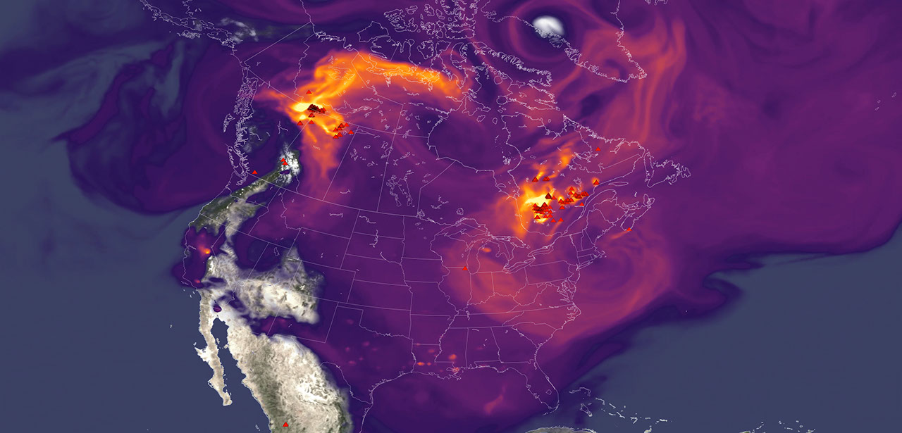
The findings underscore the capacity of smoke plumes to travel hundreds or thousands of miles from active fires, a phenomenon highlighted by the 2023 Canadian wildfires that affected air quality from the Midwest to the Northeast and South. John Haynes, manager of NASA Earth Action’s Health and Air Quality program, noted that NASA Earth observations provide critical decision-making information for air quality managers as smoke crosses state lines.
Jun Wang, an atmospheric scientist at the University of Iowa and the study’s corresponding author, emphasised that pollution from one region can significantly impact air quality in another. To assist with this challenge, Wang’s team has developed FireAQ, a decision-support system that integrates satellite observations and model forecasts into weekly briefings for state and local officials.
The analysis also highlighted the role of newer missions such as TEMPO, launched in 2023, which provides hourly daytime measurements of air quality with higher resolution than previous satellites. These capabilities, combined with ground monitoring networks, offer a more comprehensive view of smoke-related pollution patterns, particularly in rural and remote areas where ground monitors are sparse.


