Typhoon 8 emerges as JMA warns of Typhoon 7’s approach to Okinawa and Honshu
Very strong Typhoon 7 is forecast to make landfall in Okinawa Prefecture from 25 June, with potential movement toward the main island of Honshu, while Typhoon 8 has formed in southern waters.
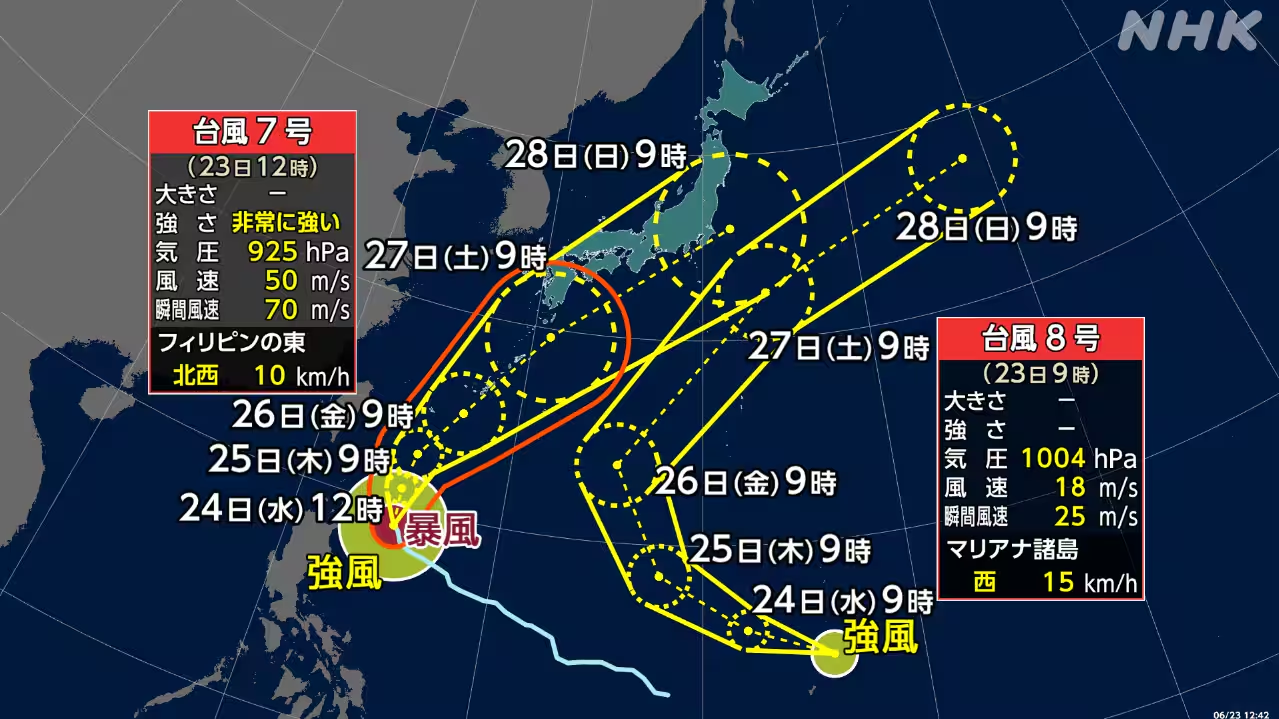
The Japan Meteorological Agency (JMA) has confirmed the formation of Typhoon 8 early on 23 June in the waters far south of Japan. The meteorological body is simultaneously tracking a very strong Typhoon 7, which is expected to approach Okinawa Prefecture from 25 June.
According to the JMA, Typhoon 7 may move closer to the main island of Honshu in addition to its projected path toward Okinawa. The agency has issued a standing advisory for the public to pay close attention to future information as the trajectories of both systems remain subject to change.
The classification of Typhoon 7 as "very strong" underscores the potential severity of the incoming weather event. While the current forecast indicates a primary approach to Okinawa, the possibility of the system moving closer to Honshu has been highlighted as a significant area of monitoring for disaster management authorities.
This development follows a series of unrelated weather and seismic incidents earlier in June. On 3 June, the JMA issued a linear rainband imminent prediction warning for southern Wakayama, Mie, and Tokushima prefectures. Subsequently, on 8 June, a tsunami advisory was issued for coastal areas from Ibaraki to Okinawa following a magnitude 8.2 earthquake, prompting evacuation orders in Kochi City.
The JMA has distinguished the current typhoon warnings from the earlier seismic events, noting that the tsunami advisory and subsequent evacuations were triggered by the earthquake rather than the current tropical cyclones. Residents in the affected regions are advised to remain vigilant regarding updates on Typhoon 7 and Typhoon 8.