Typhoon 6 brings dangerous winds to Okinawa as Japan Meteorological Agency warns of escalating disaster risk
The Japan Meteorological Agency has issued urgent warnings as Typhoon 6 moves north near Okinawa Island, prompting authorities to caution against outdoor activities amid fears of sudden weather intensification.
Typhoon 6 is currently moving north near Okinawa Island, generating very strong winds that have rendered outdoor activities dangerous across Okinawa and Amami. The Japan Meteorological Agency (JMA) is monitoring the storm’s trajectory closely as it approaches the region, with the primary concern centred on the potential for severe weather impacts in the coming hours.
According to NHK News Japan, the typhoon’s position near Okinawa Island has already resulted in hazardous conditions. Authorities are advising residents to avoid going outside due to the intensity of the winds. The agency’s warnings highlight the immediate physical risks posed by the storm’s current strength, which is expected to persist as the system moves through the area.
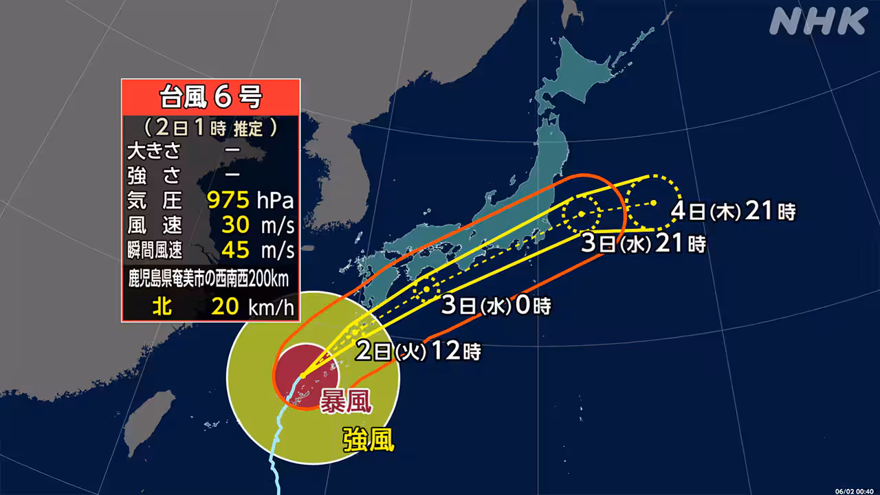
A significant escalation in disaster risk is anticipated from the early hours of June 2. The JMA has issued specific warnings regarding the potential development of line-shaped precipitation bands over southern Kyushu and Amami. These meteorological phenomena are characterised by prolonged, intense rainfall along a narrow band, which can lead to flash floods and landslides.
The Japan Meteorological Agency notes that the formation of these bands could cause a rapid increase in disaster risk. While the exact timing and intensity remain subject to change, the predictive models suggest a sudden worsening of conditions. This assessment is based on current meteorological data, and authorities are urging caution as the situation develops.
Beyond the immediate impact zones, the typhoon is forecast to bring heavy rain to regions stretching from Kyushu through to the Kanto and Chubu areas. The JMA continues to track the storm’s progress, with forecasts indicating that the weather system will affect a broad swath of the country in the days following its approach to the southern islands.
The Japan Meteorological Agency remains the primary source for these weather forecasts and typhoon tracking information. Residents in the affected regions are advised to stay informed through official channels and adhere to any evacuation orders or safety guidelines issued by local authorities. The focus remains on mitigating the risks associated with the storm’s predicted path and intensity.