Satellite imagery tracks human-caused wildfire on Santa Rosa Island
A wildland fire has burned approximately 16,600 acres on the second-largest island in the park, threatening rare Torrey pines and prompting public closures.
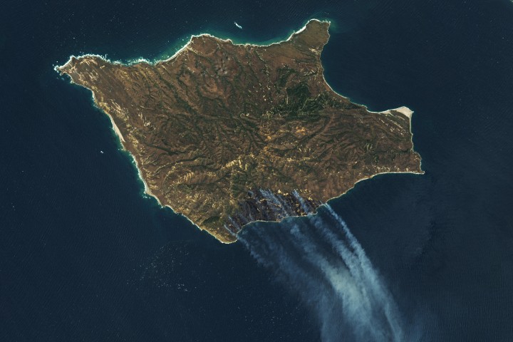
A human-caused wildland fire has consumed approximately 16,600 acres (6,700 hectares) on Santa Rosa Island, the second-largest island in California’s Channel Islands National Park. The blaze, which first appeared on May 15, 2026, spread across the southern side of the island, affecting grassland, coastal sage scrub, and chaparral. By May 19, the perimeter remained uncontained, leading to the closure of the island to the public while firefighting efforts continued.
Channel Islands National Park is a chain of five ecologically rich islands off the coast of mainland California, known for its diversity of plant and animal species. The area is often referred to as “North America’s Galapagos” due to its unique biodiversity. The fire threatened a stand of rare Torrey pines, a species that grows naturally in the United States only on Santa Rosa Island and near San Diego.
NASA’s Landsat 9 satellite captured images of the fire on May 16, 2026, showing a burned area of 5,690 acres (2,300 hectares). By May 19, the fire had expanded to approximately 16,600 acres (6,700 hectares), including much of the southeastern quadrant of the island. False-colour imagery revealed the burned area in dark brown, while infrared signatures indicated the actively burning fire front in orange. Natural-colour images showed smoke pouring over the Pacific Ocean.
Officials and news accounts said the fire was human-caused, though investigators were still working to determine the circumstances surrounding the event. The fire was fueled by dry, warm, and windy conditions, consistent with extreme fire activity reported across the U.S. Great Plains in March 2026.
The National Park Service confirmed the fire on the morning of May 15, 2026, after it was first spotted from aircraft. The island remained closed to the public while firefighters worked to contain the perimeter and protect residents and wildlife. The specific circumstances surrounding the human cause are still being investigated by authorities.
NASA Earth Observatory images were created by Lauren Dauphin, using Landsat data from the U.S. Geological Survey. The story was reported by Kathryn Hansen.


