Satellite imagery detects suspected oil slick near Iran's Kharg Island
Satellite data indicates a significant hydrocarbon dispersion in waters off Kharg Island on 10 May 2026, prompting scrutiny of Iran's critical energy infrastructure.
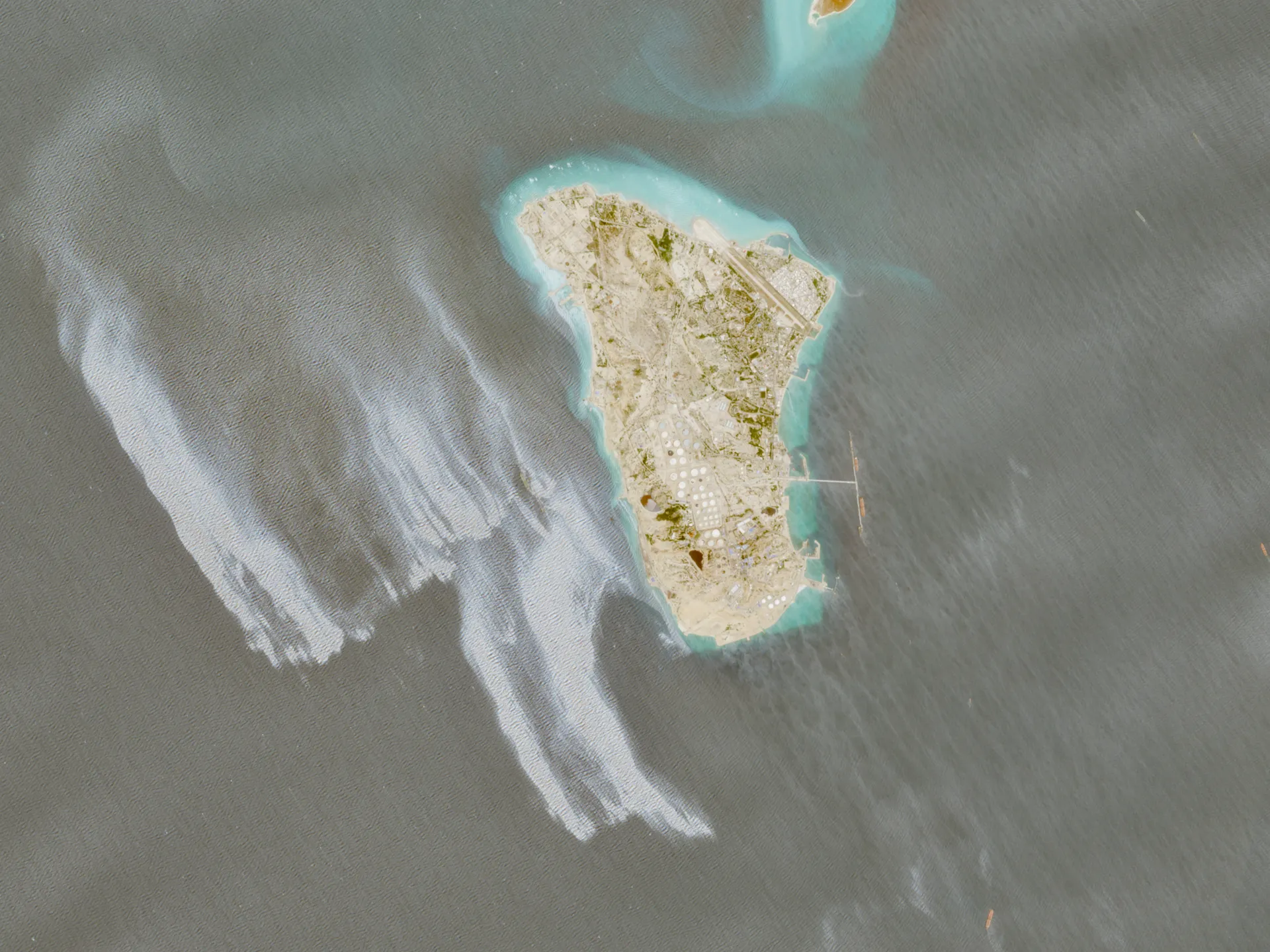
Satellite imagery has identified a suspected oil slick covering dozens of square kilometres in the waters adjacent to Iran's Kharg Island. The detection occurred on 10 May 2026, marking a significant development in the monitoring of the region's volatile energy infrastructure.
Kharg Island serves as the operational hub for Iran's oil industry and hosts the world's largest oil terminal. The location of the anomaly in these specific waters underscores the strategic sensitivity of the site, which processes a substantial volume of the nation's crude exports.
While the visual evidence from the satellite analysis suggests a substantial spill, the precise cause remains unverified. Authorities have not yet confirmed whether the dispersion resulted from a tanker accident, sabotage, or natural seepage, leaving the origin of the incident in a state of uncertainty.
The identification of the slick is based on visual analysis rather than physical sampling, meaning official confirmation from Iranian authorities or international bodies is currently awaited. This reliance on remote sensing highlights the gap between initial detection and the formal verification required to trigger a coordinated response.
Concerns regarding the potential environmental and economic impact on the Strait of Hormuz remain theoretical at this stage. Until further data is available, claims concerning immediate threats to global energy supplies or specific geopolitical consequences must be treated as speculative.
The situation continues to evolve as analysts await further intelligence to determine the extent of the spill and the necessary remedial actions.