Satellite data signals likely El Niño as warm Pacific wave reaches South America
New measurements from the international Copernicus Sentinel-6/Jason-CS mission show a warm Kelvin wave moving across the Pacific, with sea levels around Peru rising 15 centimetres above long-term averages by mid-May 2026.
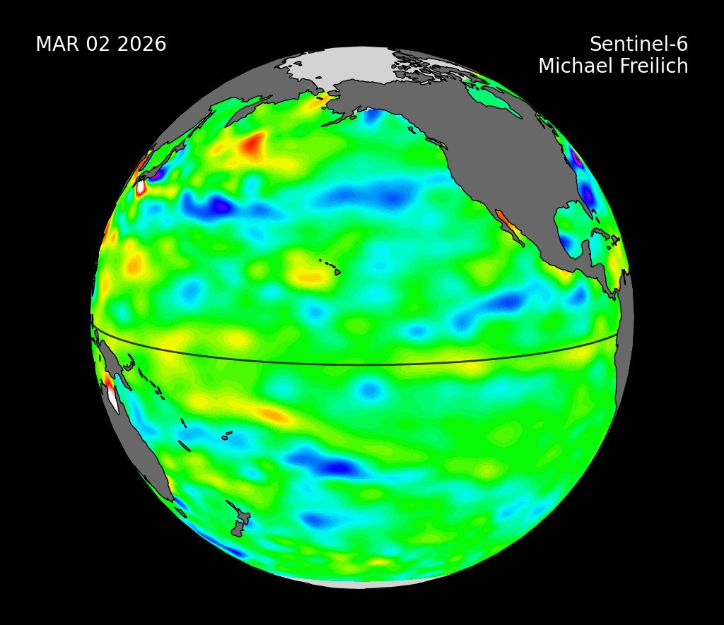
Data collected by the Sentinel-6 Michael Freilich satellite between March and May 2026 reveals a warm Kelvin wave moving from the western Pacific Ocean towards the coasts of Colombia, Ecuador, and Peru. By mid-May, sea levels around Peru were recorded at 15 centimetres (5.9 inches) above long-term averages. The emergence of this Kelvin wave in early 2026 is identified as a precursor signal indicating that an El Niño event is likely to follow.
The primary wave observed in the data emerged in early March 2026 and moved eastward over time. This followed a smaller Kelvin wave that formed around Micronesia in late January 2026 and dissipated by mid-February 2026. The satellite’s sea level height data, which signifies warmer water through higher elevation, shows the progression of the March wave towards South America.
Because water expands as it warms, a rise in sea level elevation indicates increasing temperature. The additional heat at the sea surface can alter circulation patterns of energy, water, and air in the atmosphere, which subsequently affects weather. El Niño events are known to cause heavy precipitation in some regions and deficits in others, influencing global commerce and daily life.
Sentinel-6 Michael Freilich is one of two satellites comprising the Copernicus Sentinel-6/Jason-CS mission, jointly developed by the European Space Agency (ESA), EUMETSAT, NASA, and NOAA. The mission is named after Michael Freilich, former NASA Earth Science Division Director. Funding support comes from the European Commission, with technical support on performance provided by the French space agency CNES.
NASA’s Jet Propulsion Laboratory, a division of Caltech, contributed three science instruments to each satellite: the Advanced Microwave Radiometer, the Global Navigation Satellite System - Radio Occultation, and the Laser Retroreflector Array. EUMETSAT carries out spacecraft monitoring, control, and processing of altimeter science data on behalf of the European Union’s Copernicus programme.


