Perseverance Rover Marks Western Frontier of Jezero Crater with Self-Portrait
NASA's Perseverance rover has reached the farthest western point of its mission, capturing a self-portrait that highlights geological features including megabreccia and potential volcanic dikes while continuing its fifth science campaign.
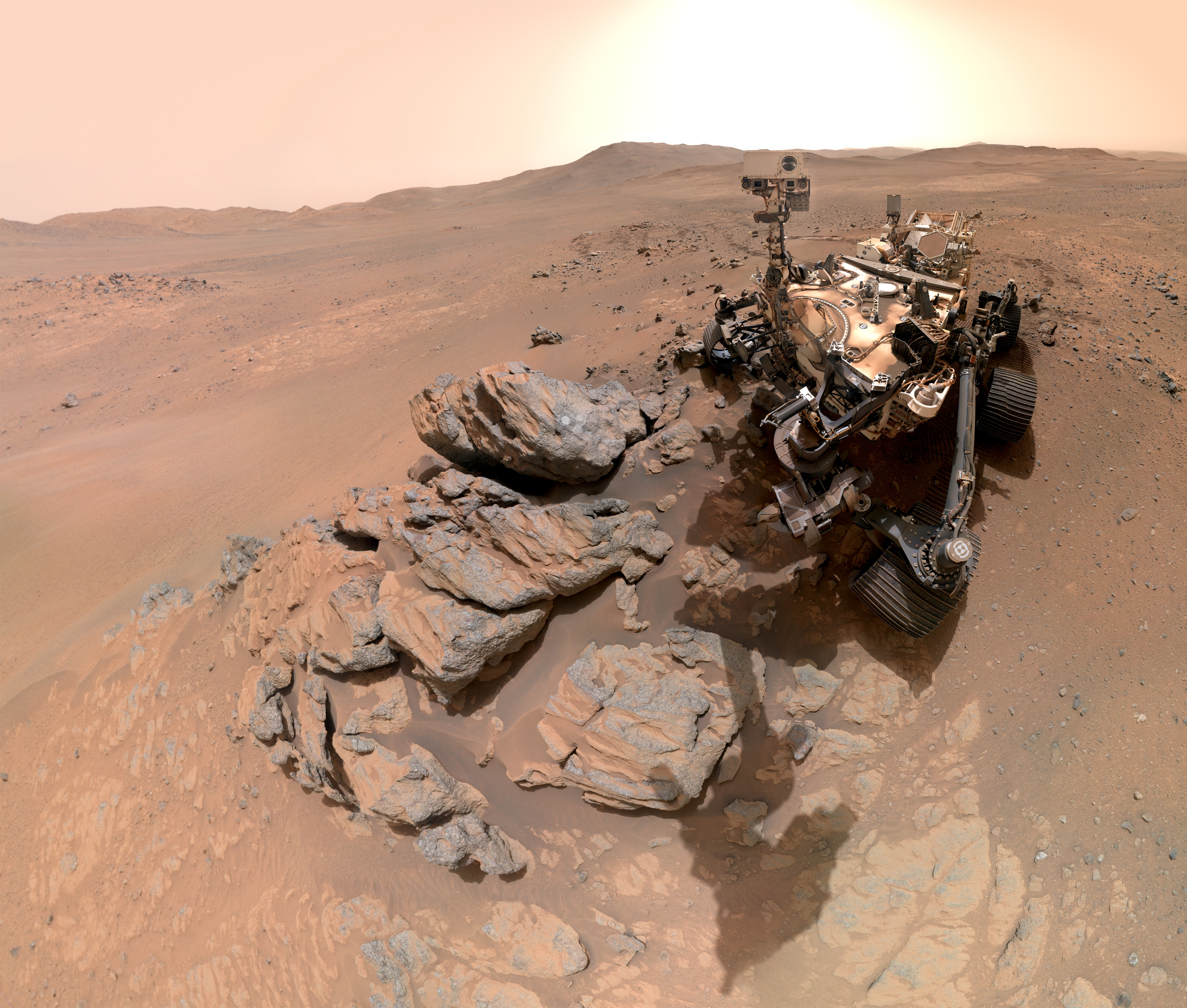
On March 11, 2026, NASA's Perseverance rover captured a composite self-portrait at Lac de Charmes, marking the farthest western point of its mission beyond the rim of Jezero Crater. The image, assembled from 61 individual shots using the WATSON camera, depicts the rover positioned after it had recently abraded the Arethusa outcrop to analyse ancient igneous minerals. This event occurred during the rover's fifth science campaign, known as the Northern Rim Campaign, representing a significant milestone in its exploration of Mars' deep early crust.
The selfie and accompanying Mastcam-Z mosaics reveal geological features including megabreccia and potential volcanic dikes, offering insights into Mars' early crust and volcanic history. Analysis of the Arethusa outcrop indicates it is composed of igneous minerals likely predating the formation of Jezero Crater, formed from molten rock cooling underground. These findings provide a window into the planet's deep geological past, distinct from the sedimentary river delta found within the crater itself.
Since landing on Mars, Perseverance has travelled approximately 26 miles and abraded 62 rocks during its fifth science campaign. The rover has also collected 27 rock cores, with 25 sealed and two unsealed, for potential return to Earth. The journey to Lac de Charmes demonstrates the endurance of the mission, which the team describes as a marathon rather than a sprint, with the rover now approaching ultramarathon drive distances.
Following the selfie, the rover is scheduled to proceed to a site called Gardevarri to study olivine-bearing rocks, followed by a move to Singing Canyon. These upcoming locations are expected to provide further insights into the planet's early crust and large-scale geological processes. The study of these ancient rocks could offer insights applicable to the entire planet, such as whether there was a magma ocean on Mars and what initial conditions eventually made it a habitable world.
The WATSON imaging system, built and operated by Malin Space Science Systems in San Diego, was used to make 62 precision movements over approximately one hour to build the composite image. Alongside the selfie, Perseverance used Mastcam-Z to capture a mosaic of the Arbot area on April 5, revealing a windswept landscape of diverse rock textures. This panorama offers one of the richest geological vistas of the mission, providing a clear road map for investigating the ridgeline and the area's ancient rock variety.
NASA's Jet Propulsion Laboratory, managed for the agency by Caltech, built and manages operations of the Perseverance rover on behalf of NASA's Science Mission Directorate. The mission continues to explore the objects in our solar system to better understand its history, with Perseverance serving as the first leg of the Mars Sample Return Campaign's interplanetary relay team.