NASA's LAGEOS Satellite: A Half-Century of Millimetre-Precise Earth Measurement
For fifty years, the durable aluminium sphere has provided critical data on Earth's shape, gravity field, and crustal movements using laser ranging technology.
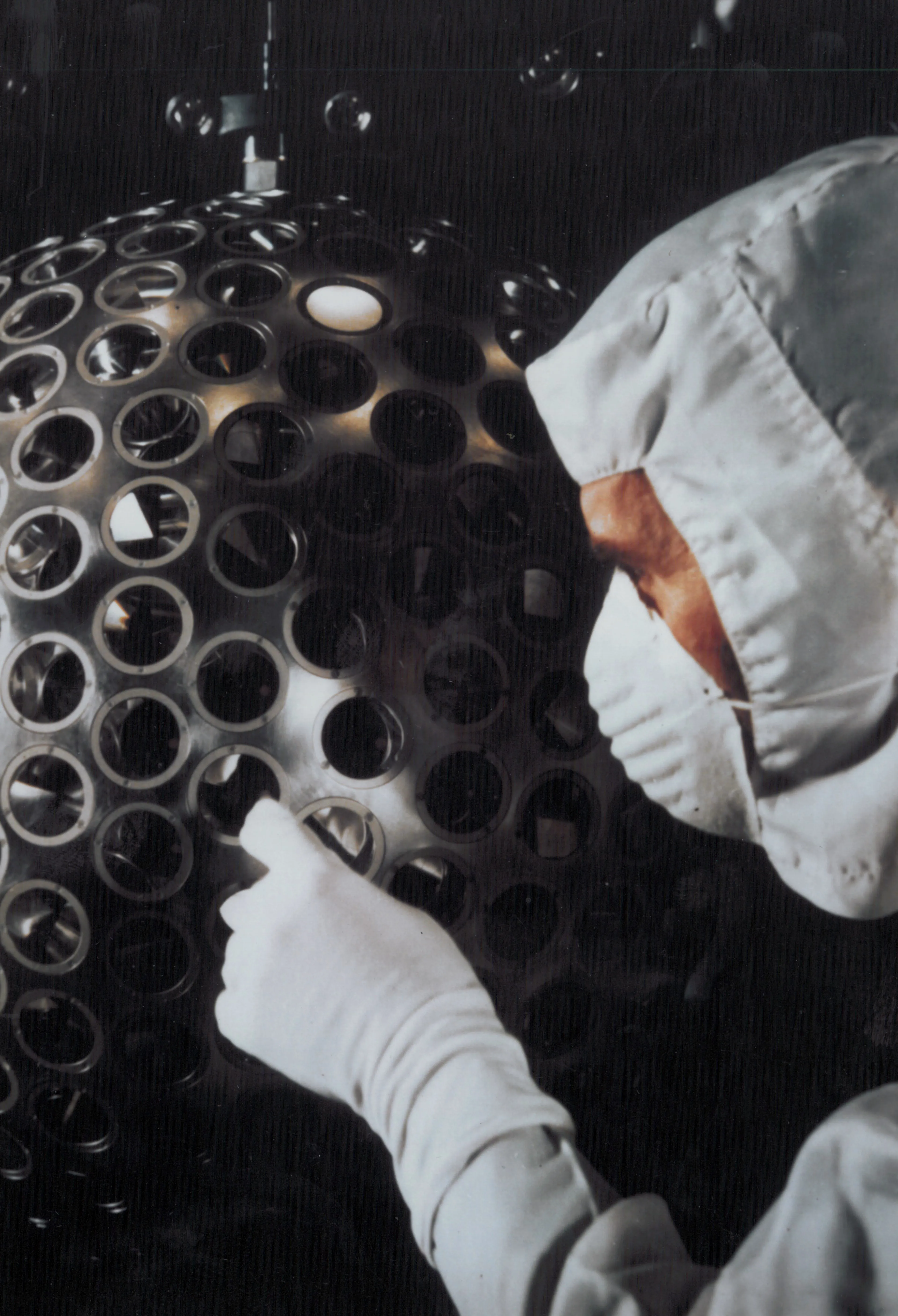
On 4 May 1976, the Laser Geodynamics Satellite, known as LAGEOS, entered orbit approximately 3,700 miles above the Earth. Described by NASA as a durable Earth science mission, the spacecraft resembles a shiny, two-foot-wide sphere covered in 426 retroreflectors. These small mirrored prisms are designed to bounce laser light directly back to the source, enabling scientists to measure distance with millimetre precision.
The satellite's physical design was engineered specifically for stability. Beneath its aluminium exterior lies a dense brass core, giving the 900-pound sphere a mass of 400 kilograms. This high weight, combined with its compact spherical shape, ensures an exceptionally stable orbit with minimal atmospheric drag. From ground stations around the world, researchers fire pulses of laser light at the satellite and calculate the distance based on the time taken for the light to return.
Over the last five decades, this ultra-precise measurement capability has allowed scientists to track the slow movements of Earth's tectonic plates and monitor tiny shifts in the planet's crust. The data collected has also been used to measure motion along major fault lines, providing long-term benchmarks for understanding geological activity. Furthermore, the mission has contributed to tests of Einstein's theory of general relativity by helping confirm predicted effects on the orbits of massive bodies around the Earth.
To improve measurement accuracy, a near-identical twin satellite, LAGEOS II, was launched in 1992 aboard the space shuttle Columbia. Built by the Italian Space Agency, this second satellite complements the original, allowing scientists to compare data and refine models of the planet's gravity field and overall shape. Together, the two satellites serve as enduring tools for global geodesy.
Despite being among the oldest scientific satellites still in service, LAGEOS continues to operate without maintenance. Its simple design and high orbit mean it is expected to remain in space for millions of years. This longevity underscores the success of the mission, which has provided over fifty years of continuous data to refine our understanding of the Earth's dynamic interior.
NASA describes the project as one of its longest-standing science experiments, observing the planet from space with a focus on enduring precision. The mission demonstrates how a single, robust piece of technology can yield decades of valuable information regarding the Earth's structure and the fundamental laws of physics.


