NASA explains the otherworldly geology of Vasquez Rocks
Sedimentary layers in Southern California’s Soledad Basin tilt at an average of about 50 degrees after millions of years of deposition, tectonic deformation and erosion.
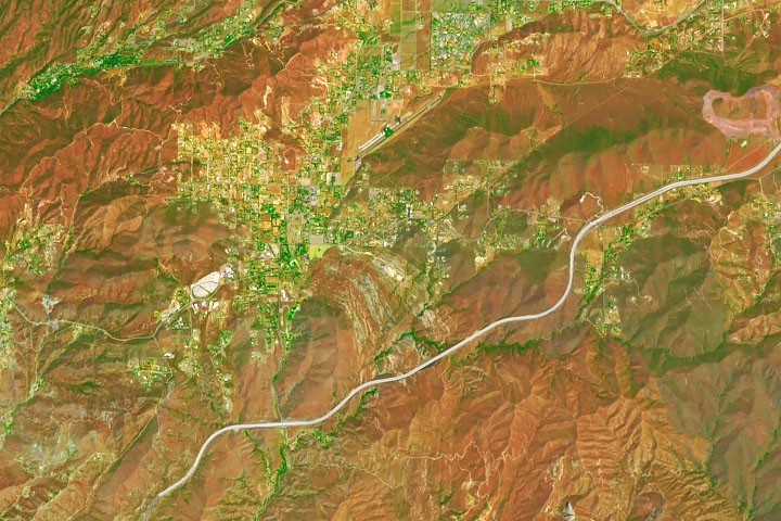
NASA has detailed how the striking formations at Vasquez Rocks Natural Area in Southern California came to jut from the Soledad Basin at steep angles. Geologists estimate that the area’s sedimentary strata tilt by an average of about 50 degrees.
The rocks began forming about 25 million years ago, when sediment spread across alluvial fans as fast-moving streams emptied onto relatively flat plains. NASA says the sediment likely eroded from nearby uplands and had not travelled far.
Over time, the deposits were buried and cemented into thick layers of sandstone and conglomerate. Tectonic activity associated with the plate boundary that includes the San Andreas Fault then reshaped the region, uplifting and deforming the Soledad Basin.
The sedimentary layers gradually tilted, folded and rotated. Once exposed at the surface, millions more years of weathering and erosion removed softer material, leaving the more resistant ridges and fins visible today.
The formations appear as grey bands between mountain ranges in Landsat 9 imagery captured by the satellite’s Operational Land Imager. NASA also notes Vasquez Rocks’ long association with film and television, including Star Trek, in which the site represented Vulcan in two films.