Mount Dukono erupts in Indonesia, killing hikers and raising alert levels
Satellite data and ground surveys confirm sustained eruptive events as authorities enforce exclusion zones following fatal incidents.
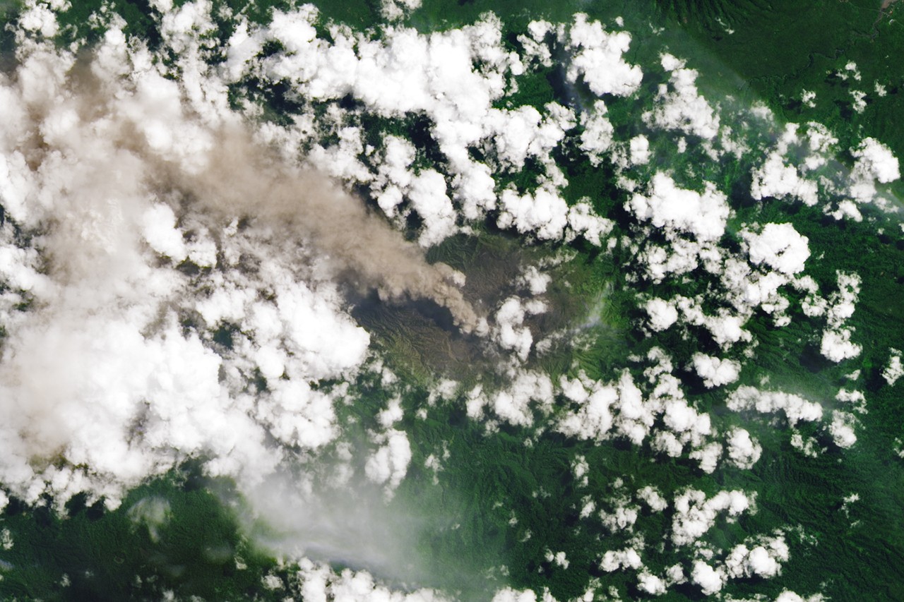
Mount Dukono, a stratovolcano situated at the northern end of Indonesia’s Halmahera Island, has remained in a state of near-continuous eruption since 1933. In May 2026, heightened activity resulted in fatalities when ash and volcanic bombs struck a group of hikers. The incident prompted Indonesian authorities to raise the alert level to 2 on a scale of 4 and establish a four-kilometre exclusion zone around the crater.
Data from the Indonesian volcanological survey indicates that between May 9 and May 16, 2026, the volcano recorded an average of 52 eruptive events per day. During this period, ash plumes rose between 400 and 4,300 metres above the summit. The volcano routinely ejects volcanic bombs, which are hunks of semi-molten rock, hundreds of metres from its vent, a hazard that contributed to the tragedy on May 8, 2026.
Satellite observations have corroborated the intensity of the activity. NASA and other U.S. government satellites detected thermal anomalies, ash plumes, and sulfur dioxide emissions in the days following the fatal incident. These detections align with ground reports of frequent emissions of ash and volcanic gases, which characterise the behaviour of this remote stratovolcano.
The activity at Mount Dukono occurs within a highly active volcanic region. According to the Global Volcanism Program, there were nine actively erupting volcanoes in Indonesia in May 2026, the highest number of any country at that time. Since the 1960s, eruptions have occurred at 55 volcanoes in Indonesia, a total that exceeds that of any other nation.
For comparative context, Japan ranks second with 40 volcanoes erupting since the 1960s, followed by the United States with 39. While such activity is typical for the Southeast Asian archipelago, the persistence of activity at Mount Dukono stands out even among eruption-prone countries. The volcano is known for near-daily rumbles and frequent emissions, maintaining a state of unrest that has persisted for nearly a century.
Imagery of the activity was produced by Lauren Dauphin using Landsat data from the U.S. Geological Survey, with the story written by Adam Voiland for the NASA Earth Observatory. The data underscores the ongoing geological processes shaping the landscape of Halmahera Island and the broader Indonesian archipelago.


