Japan issues highest landslide warnings as Typhoon 7 advances
The Japan Meteorological Agency has activated Level 4 landslide danger alerts in parts of northern Kyushu, urging immediate evacuation as Typhoon 7 moves north and threatens to intensify rainfall across the archipelago.
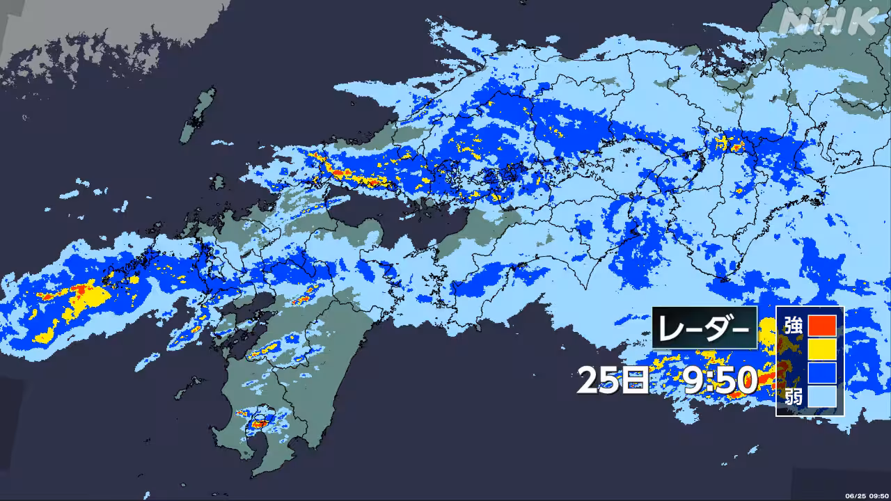
Continuous rainfall in northern Kyushu, driven by a stalled plum rain front, has prompted the Japan Meteorological Agency to issue Level 4 landslide danger alerts in some areas. The alert level, part of the country’s new disaster weather information system, indicates extreme danger and requires immediate evacuation from high-risk zones.
The northward movement of Typhoon 7 is expected to exacerbate the situation, with forecasts predicting increased rainfall across western and eastern Japan. The storm’s trajectory poses a significant risk to infrastructure and public safety as it interacts with the existing atmospheric instability caused by the lingering rain front.
Okinawa and the Amami Islands are also facing further risks from the approaching typhoon. While specific details regarding the nature of the threats to these southern regions remain partially outlined in initial reports, authorities are maintaining heightened vigilance as the weather system develops.
This event follows a period of volatile weather patterns across the nation. Earlier in the year, Typhoon 6 had approached the same southern regions, bringing violent winds and heavy rain from Kyushu to the Kanto and Chubu regions. The current situation marks a shift from the severe heat exceeding 30 degrees Celsius forecast for late May, replacing high temperatures with dangerous precipitation levels.
Authorities are urging residents in affected areas to monitor local disaster information closely. The combination of the stalled front and the advancing typhoon creates a compound risk scenario, requiring strict adherence to evacuation orders and preparedness measures as the weather system continues to evolve.