France confronts unprecedented fire thunderstorms as climate-driven weather systems complicate Gironde response
As President Macron prepares to visit the fire-ravaged southwest, researchers warn that the convergence of successive heatwaves and local convection has created a new category of unpredictable disaster.
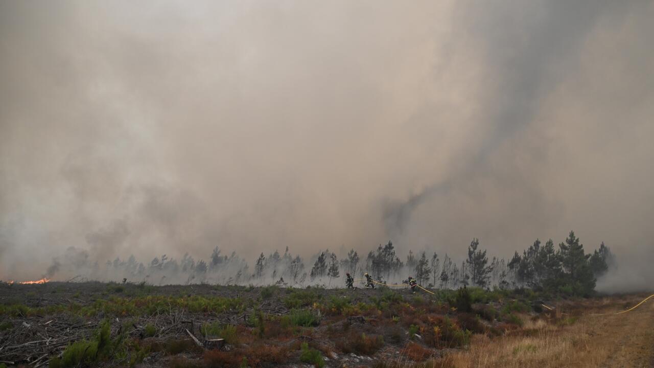
French emergency services are grappling with a meteorological phenomenon previously unseen in sustained form within the country, as extreme wildfires in the southwest Gironde region generate their own weather systems. Firefighters are confronting pyrocumulonimbus clouds, commonly referred to as fire clouds, which produce internal wind currents and lightning that can ignite new blazes, thereby complicating containment efforts in an already volatile environment.
Jean-Baptiste Filippi, a French wildfire researcher, attributes the emergence of these conditions to human-caused climate change. He notes that while thunderstorms are not uncommon in the region, the specific combination of such conditions following three successive heatwaves represents a new and dangerous dynamic. This convergence has created what Filippi describes as unpredictable and catastrophic circumstances for local authorities.
The mechanics of the phenomenon involve a column of air rising rapidly above the fire, forming an anvil-shaped cumulonimbus cloud. Updrafts within these systems can exceed 150 kilometres per hour. Although rain may form, it often evaporates before reaching the ground, yet the resulting cooling of the atmosphere generates strong downdrafts. This self-sustaining cycle exacerbates fire spread through erratic wind shifts and the long-distance transport of embers.
While pyrocumulonimbus clouds are a known hazard in Portugal, California, and Australia, this marks the first time they have been observed as a persistent threat in France. Although isolated instances occurred in Landiras south of Bordeaux in 2022, they did not persist. The current event in Gironde, which has prompted mass evacuations and military mobilisation, highlights the need for adapted management strategies for fires that generate their own wind.
Forecasting these events presents a significant challenge for weather services. While general thunderstorm conditions can be predicted, the exact location of the fire-induced storms cannot be determined in advance, as the storms form directly above the active fire. This unpredictability, combined with the potential energy in the atmosphere, has led to staggering rates of fire spread and localised convection columns that draw in embers.
President Macron is scheduled to visit the fire-ravaged southwest as a new heatwave is expected to descend on the country. The intensity of the Gironde fires has created a dual threat, with lightning strikes potentially igniting fresh blazes in an area characterised by unstable atmospheric conditions. The experience in Portugal, where such events became more frequent after the deadly 2017 Pedrogao Grande fires, serves as a cautionary precedent for French authorities.
The exact long-term frequency of these events in France remains uncertain, as this is the first sustained observation of the phenomenon. However, the immediate priority for emergency responders is managing the current crisis, where local conditions have shifted rapidly from northerly to westerly, southerly, and easterly winds, further complicating the containment strategy.