ESA enhances Copernicus Browser with high-resolution wildfire tracking layer
The European Space Agency has integrated a remote sensing script into its free satellite imagery platform, allowing users to distinguish active fires and burned landscapes at 10-metre resolution.
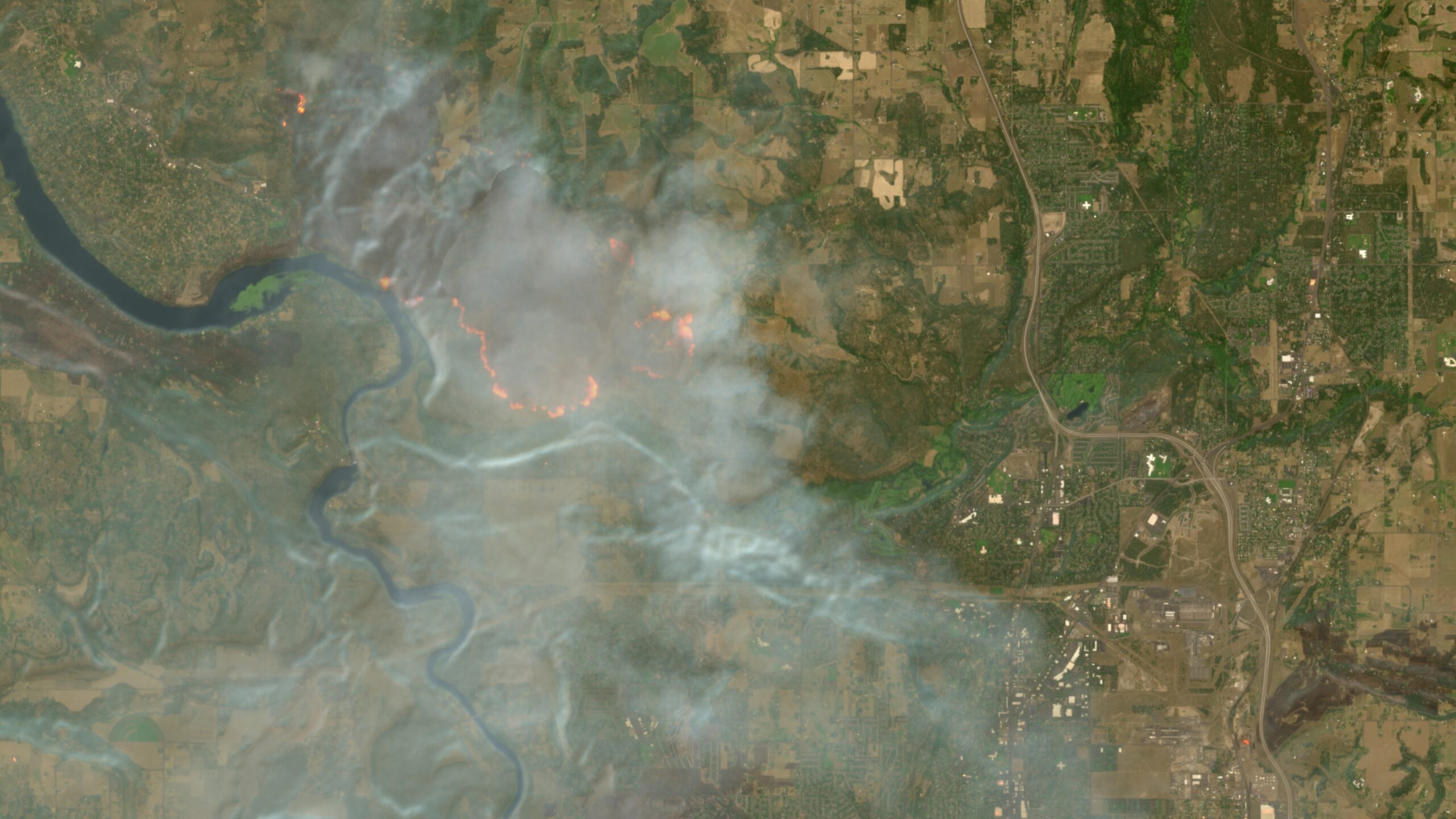
The European Space Agency has integrated a new wildfire visualization layer into the Copernicus Browser, a free satellite imagery service operated for the European Union’s Earth observation program. The enhancement, which went live on August 4, utilises Sentinel-2 satellite data to help users identify active fires, burning vegetation, and burned landscapes through specific spectral band combinations. This update coincides with a record-breaking wildfire season impacting regions such as France, Spain, Canada, and parts of the United States.
The new feature allows users to distinguish active fires, which appear in white or yellow, burning vegetation in red, and burned landscapes in dark brown or black. The visualization script was originally developed by remote sensing expert Pierre Markuse nearly a decade ago. It combines the red visible light band, the narrow near-infrared band to highlight differences between healthy and burned vegetation, and the short-wave infrared 2 band to reveal soil moisture levels.
Prior to this integration, the script was available only as a manual custom addition. Users had to copy and paste the JavaScript code into the browser’s custom visualization option to access the data. Simon Proud, mission scientist for Sentinel-2 at the European Space Agency, facilitated the change to make the tool a default option. Proud announced the integration in a Discord channel on a server run by the investigative journalism group Bellingcat.
The Copernicus Browser provides free access to the latest imagery from the European Space Agency’s Sentinel satellites. The three satellites of the Sentinel-2 mission provide multi-spectral imaging at resolutions as granular as 10 metres in visible light and near-infrared bands. While other tools like NASA’s FIRMS offer faster updates within several hours, their imagery is available at coarser resolutions down to 250 metres. Sentinel-2 imagery is updated every few days but offers significantly higher spatial resolution.
Climate change is exacerbating traditional wildfire seasons globally, increasing the demand for high-resolution monitoring tools. Current blazes are affecting Washington and Oregon in the United States, while Canada faces one of its worst wildfire seasons on record. In Europe, firefighters continue to battle blazes in France and Spain, where hundreds of thousands of people have evacuated during the record-breaking season.