Google-backed FireSat constellation launches as North American wildfires intensify
The first three satellites designed by Muon Space and managed by the Earth Fire Alliance entered orbit on July 7, aiming to detect sub-five-metre blazes through smoke and cloud cover.
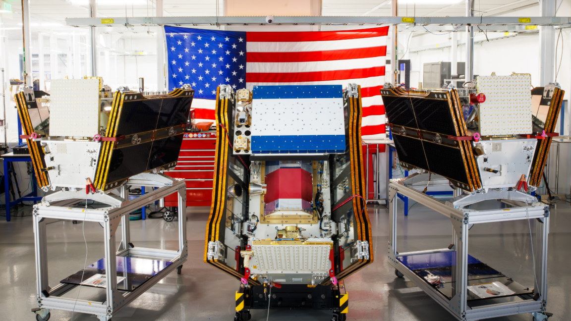
The first three operational satellites of the Google-backed FireSat program launched on July 7, 2026, from Vandenberg Space Force Base aboard a SpaceX Falcon 9 rocket. This deployment marks the transition to initial operational capability for the constellation, which is managed by the nonprofit Earth Fire Alliance and designed by California-based manufacturer Muon Space. The satellites are equipped with multispectral imaging capable of detecting fires as small as five by five metres through smoke and cloud cover, addressing critical gaps in current detection capabilities.
The launch coincides with severe wildfire activity in Canada’s boreal forests and the United States, which have generated hazardous smoke affecting over 100 million people. As of July 17, 2026, the Canadian Wildland Fire Information System reported nearly 900 active wildfires in Canada, with more than 6.6 million acres burned to date. The intensity of these blazes has strained firefighting resources, forcing agencies to monitor dozens of out-of-control fires rather than actively suppress them due to limited assets.
Early adopter organisations receiving data this year include fire agencies in California, Colorado, Australia, and Portugal. After a three-month testing period, the satellites will begin actively providing data while covering every fire-prone region on Earth at least twice per day. The Earth Fire Alliance projects that an hourly revisit rate could save more than $1 billion in fire damage costs and prevent nearly 22 million tons of carbon emissions.
To assist with detection, Google Research plans to use AI models to compare operational FireSat data with historical images to identify small fires and inform predictive modelling. Google has acknowledged that its company-wide electricity usage grew by 37 per cent in 2025, highlighting challenges in offsetting emissions from energy-hungry data centres. The company described the launch as a step forward in putting practical AI to work for climate resilience, though the broader push for AI infrastructure has been linked to increased greenhouse gas emissions.
Traditional fire suppression strategies are increasingly overwhelmed by global warming, with the last three fire seasons in Canada among the 10 worst on record. To address immediate resource shortages, the Canadian government leased 10 new aerial firefighting aircraft as surge assets for provinces, which typically bear the cost of such resources. The FireSat program aims to provide imagery every 20 minutes once the full constellation of more than 50 satellites is launched by the early 2030s.